![](/images/other/stat-length.png)
![Tour Wandern La Coucourde - alpion1 - Photo](https://media.geolcdn.com/t/1900/400/2c9b823b-5480-41f7-9cf0-b42ad1cd93ac.jpg&format=pjpeg&maxdim=2)
alpion1
parastat
Benutzer
![Länge](/images/other/stat-length.png)
Länge
6,3 km
![Maximale Höhe](https://static1.geolcdn.com/siteimages/upload/files/1508320355ic_sort_altitude_max_24dp.png)
Maximale Höhe
388 m
![Positive Höhendifferenz](https://static1.geolcdn.com/siteimages/upload/files/1508320355ic_sort_den_pos_24dp.png)
Positive Höhendifferenz
241 m
![Km-Effort](/images/other/stat-length.png)
Km-Effort
9,5 km
![Min. Höhe](https://static1.geolcdn.com/siteimages/upload/files/1508320355ic_sort_altitude_min_24dp.png)
Min. Höhe
177 m
![Negative Höhendifferenz](https://static1.geolcdn.com/siteimages/upload/files/1508320355ic_sort_den_neg_24dp.png)
Negative Höhendifferenz
237 m
![Boucle](https://static1.geolcdn.com/siteimages/upload/files/16400158638029165_repeat_loop_refresh_sync_direction_icon.png)
Boucle
Ja
Erstellungsdatum :
2022-05-26 12:00:16.599
Letzte Änderung :
2022-05-26 15:41:49.504
![Wandern](https://static1.geolcdn.com/sitytour/trail-icons/101.png)
2h00
Schwierigkeit : Medium
![Scannen Sie diesen QR-Code, um die Tour in der SityTrail-Anwendung zu öffnen](https://capi.geolives.com/qq0zvz2zws4bq2lad0pu/sitytour/trails/3257757/qr.png?size=200)
Kostenlosegpshiking-Anwendung
Über SityTrail
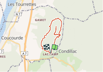
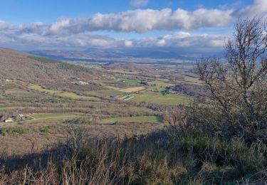
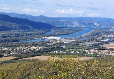
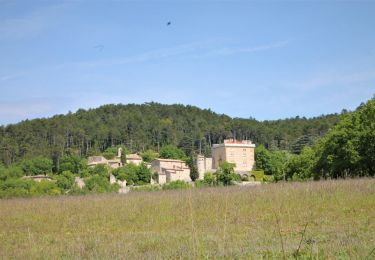
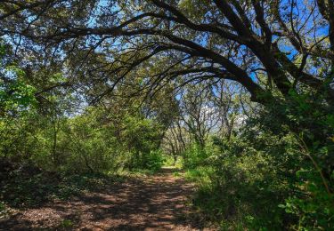
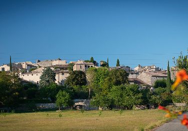
Tour Wandern von 6,3 km verfügbar auf Auvergne-Rhone-Alpen, Drôme, La Coucourde. Diese Tour wird von parastat vorgeschlagen.
Beschreibung
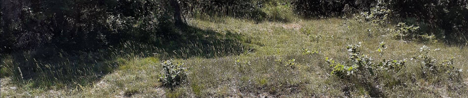
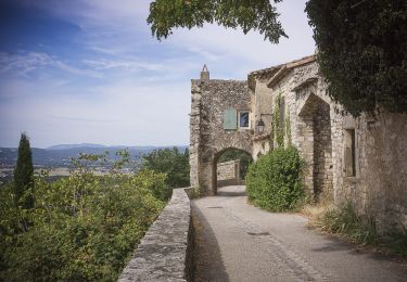
IL est dommage de ne pas faire l'aller retour jusqu'au sommet, borne, point côté, pas beaucoup de vue mais le petit sentier est bien sympa.
Ort
Land:
France
Region :
Auvergne-Rhone-Alpen
Abteilung/Provinz :
Drôme
Kommune :
La Coucourde
Standort:
Unknown
Gehen Sie:(Dec)
Gehen Sie:(UTM)
643344 ; 4944662 (31T) N.
Kommentare
Touren in der Umgebung
![Tour Wandern Cruas - 07 cruas st Vincent de barres - Photo](https://media.geolcdn.com/t/375/260/b6e3219f-7af9-4a24-ac52-2d001f2a1138.jpg&format=jpg&maxdim=2)
![Wandern Wandern](https://static1.geolcdn.com/sitytour/trail-icons/101.png)
07 cruas st Vincent de barres
Wandern
Medium
(1)
Cruas,
Auvergne-Rhone-Alpen,
Ardèche,
France
![](/images/other/stat-length.png)
14,9 km | 25 km-effort
4h 23min
![](https://static1.geolcdn.com/siteimages/upload/files/16400158638029165_repeat_loop_refresh_sync_direction_icon.png)
Ja
![Tour Wandern Sauzet - Sauzet Les Grands Abris 7km5 - Photo](https://media.geolcdn.com/t/375/260/dc904df7-2d15-4473-9afc-0180c6e306df.jpg&format=jpg&maxdim=2)
![Wandern Wandern](https://static1.geolcdn.com/sitytour/trail-icons/101.png)
Sauzet Les Grands Abris 7km5
Wandern
Medium
(1)
Sauzet,
Auvergne-Rhone-Alpen,
Drôme,
France
![](/images/other/stat-length.png)
7,3 km | 11,7 km-effort
2h 26min
![](https://static1.geolcdn.com/siteimages/upload/files/16400158638029165_repeat_loop_refresh_sync_direction_icon.png)
Ja
![Tour Wandern Condillac - Condillac](https://media.geolcdn.com/t/375/260/3f6d13ae-e018-4efe-bd90-18499af23fce.jpg&format=jpg&maxdim=2)
![Wandern Wandern](https://static1.geolcdn.com/sitytour/trail-icons/101.png)
Condillac "Le Rocher de Ruas" 7km.
Wandern
Medium
(1)
Condillac,
Auvergne-Rhone-Alpen,
Drôme,
France
![](/images/other/stat-length.png)
7,1 km | 11,6 km-effort
2h 38min
![](https://static1.geolcdn.com/siteimages/upload/files/16400158638029165_repeat_loop_refresh_sync_direction_icon.png)
Ja
![Tour Wandern La Coucourde - La Coucourde : Alpion et Tas de Pierre 6km - Photo](https://media.geolcdn.com/t/375/260/31960cbb-c19d-4c4a-8955-5c85ef0479f9.jpg&format=jpg&maxdim=2)
![Wandern Wandern](https://static1.geolcdn.com/sitytour/trail-icons/101.png)
La Coucourde : Alpion et Tas de Pierre 6km
Wandern
Medium
La Coucourde,
Auvergne-Rhone-Alpen,
Drôme,
France
![](/images/other/stat-length.png)
6 km | 8,9 km-effort
2h 3min
![](https://static1.geolcdn.com/siteimages/upload/files/16400158638029165_repeat_loop_refresh_sync_direction_icon.png)
Ja
![Tour Wandern Condillac - 2022-09-27_13h26m12_14402804 - Photo](https://media.geolcdn.com/t/375/260/682fa6c2-f9ec-4b30-ade4-a125a2ae7aa0.jpg&format=jpg&maxdim=2)
![Wandern Wandern](https://static1.geolcdn.com/sitytour/trail-icons/101.png)
2022-09-27_13h26m12_14402804
Wandern
Medium
Condillac,
Auvergne-Rhone-Alpen,
Drôme,
France
![](/images/other/stat-length.png)
10,6 km | 16,3 km-effort
3h 41min
![](https://static1.geolcdn.com/siteimages/upload/files/16400158638029165_repeat_loop_refresh_sync_direction_icon.png)
Ja
![Tour Wandern Saint-Marcel-lès-Sauzet - 2022-09-27_13h20m15_14402792 - Photo](https://media.geolcdn.com/t/375/260/9b95d8f7-96bf-4e7c-a753-aa87110b6003.jpeg&format=jpg&maxdim=2)
![Wandern Wandern](https://static1.geolcdn.com/sitytour/trail-icons/101.png)
2022-09-27_13h20m15_14402792
Wandern
Einfach
Saint-Marcel-lès-Sauzet,
Auvergne-Rhone-Alpen,
Drôme,
France
![](/images/other/stat-length.png)
6,3 km | 9 km-effort
2h 1min
![](https://static1.geolcdn.com/siteimages/upload/files/16400158638029165_repeat_loop_refresh_sync_direction_icon.png)
Ja
![Tour Wandern Sauzet - 2022-09-27_13h19m12_14402793-2 - Photo](https://media.geolcdn.com/t/375/260/7a0f940a-b445-4320-8788-dc8b4c52f3c2.jpg&format=jpg&maxdim=2)
![Wandern Wandern](https://static1.geolcdn.com/sitytour/trail-icons/101.png)
2022-09-27_13h19m12_14402793-2
Wandern
Medium
Sauzet,
Auvergne-Rhone-Alpen,
Drôme,
France
![](/images/other/stat-length.png)
7,3 km | 11,8 km-effort
2h 40min
![](https://static1.geolcdn.com/siteimages/upload/files/16400158638029165_repeat_loop_refresh_sync_direction_icon.png)
Ja
![Tour Wandern Savasse - 2022-09-26_14h15m29_13096793 - Photo](https://media.geolcdn.com/t/375/260/2b473090-d36a-43fd-b8eb-9c5f8eb23398.jpg&format=jpg&maxdim=2)
![Wandern Wandern](https://static1.geolcdn.com/sitytour/trail-icons/101.png)
2022-09-26_14h15m29_13096793
Wandern
Medium
Savasse,
Auvergne-Rhone-Alpen,
Drôme,
France
![](/images/other/stat-length.png)
6,9 km | 10,4 km-effort
2h 21min
![](https://static1.geolcdn.com/siteimages/upload/files/16400158638029165_repeat_loop_refresh_sync_direction_icon.png)
Ja
![Tour Motor Saulce-sur-Rhône - sortie 4x4 - Photo](https://media.geolcdn.com/t/375/260/ext.jpg?maxdim=2&url=https%3A%2F%2Fstatic1.geolcdn.com%2Fsiteimages%2Fupload%2Ffiles%2F15247431544x4.jpg)
![Motor Motor](https://static1.geolcdn.com/sitytour/trail-icons/400.png)
sortie 4x4
Motor
Schwierig
(1)
Saulce-sur-Rhône,
Auvergne-Rhone-Alpen,
Drôme,
France
![](/images/other/stat-length.png)
94 km | 136 km-effort
10h 48min
![](https://static1.geolcdn.com/siteimages/upload/files/16400158638029165_repeat_loop_refresh_sync_direction_icon.png)
Nein